What a difference a year makes! This time last year was one of the driest in memory on VanIsle.
Season after season, we’ve been hearing ‘record high temperatures’ across our island and all across the globe.
But this spring, we’ve had colder, wetter conditions.
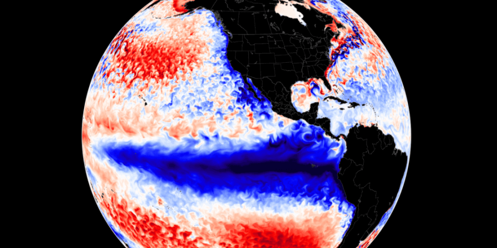
Environment Canada meteorologist Brian Proctor chalks it up to La Niña rolling through and delaying spring.
Proctor expects the rest of May—including the coming Victoria Day long weekend—to be a write-off for warmer temperatures. But he predicts things should return to normal by mid-to-late June.
“It’s looking like a normal set of summer conditions,” he said. “We just need to get through what people call the May-June gloom this time of year.”
Gloomy indeed, as a cold front smashed daytime records for a slew of cities and towns on the coast and the eastern edge of Vancouver Island.
- Victoria: 10.6°C, breaking record from 1945 (records go back to 1914)
- Vancouver: 10.5°C, breaking the record from 1964 (records go back to 1896)
- Sechelt: 8.7°C; old record of 11.7°C set in 1986.
- Qualicum Beach: New record of 8.7°C, smashing the old record of 12°C from 1925
- Powell River: New record of 8.4°C, colder than the old record of 10.4°C set in 1986
- Port Alberni: 8.4°C, colder than the previous record of 11.7°C from 1911 (records go back to 1900)
- Nanaimo: 8.9°C, smashing records from 1911
Several communities also broke rainfall records, including Powell River, which saw 45.5mm on May 12.
And VanIsle was treated to a fall storm in the middle of May this week. Gusts of up to 90 km/hr brought down trees and knocked out power to thousands.
“La Nina is lingering, and it’s held on longer than we would have thought it would have initially,” Proctor said. “It’s just been a cool, slow start to spring. And we’re not really seeing anything indicating really substantial warming at this point in time right through the end of the month.”
So we may be looking into mid-June before any real heat comes through.
Although rainfall has been high, the water levels in the Comox Lake reservoir are lower than normal.
BC Hydro stakeholder engagement advisor Stephen Watson says there’s nothing to worry about.
“The Comox Lake Reservoir is currently at 132m, and that’s below normal for this time of year,” said Watson.
“The cooler weather has limited the water inflows into the reservoir during the recent wet period. As the weather warms up, the freshet [spring thaw] will begin, and we plan on having the reservoir full by June.”
So it seems, for this year at least, we are swapping our usual island Juneuary for the new Mayvember.
